
Arctic Terns at Half Moon Bay (37°28'32.3'' N, 122°26'55.2'' W, 4 m)

Arctic Terns at Half Moon Bay (37°28'32.3'' N, 122°26'55.3'' W, 0 m)
| [<- Overview] |
This page shows all 65 panoramic images from our California round trip in June 2009, in chronological order. These are images that are composed of several single pictures taken from the same location. If only a few pictures are involved, e.g., here, such a panoramic image does not differ much from a single picture taken with a wide-angle lens.You can click on a date below to go to the page showing all pictures of the respective day.
 Arctic Terns at Half Moon Bay (37°28'32.3'' N, 122°26'55.2'' W, 4 m) |
 Arctic Terns at Half Moon Bay (37°28'32.3'' N, 122°26'55.3'' W, 0 m) |
|
|
 360° panoramic view at San Francisco Bay (37°48'26.5'' N, 122°26'11.7'' W, 0 m)
|
 Golden Gate Bridge, San Francisco (37°48'26.5'' N, 122°26'11.7'' W, -3 m)
|
 Park at the Palace of Fine Arts, San Francisco (37°48'9.7'' N, 122°26'48.9'' W, 35 m)
|
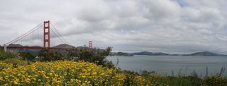 Golden Gate Bridge seen from Fort Point, San Francisco (37°48'29.1'' N, 122°28'22.9'' W, 30 m)
|
 180° panoramic view at Fort Point, San Francisco (37°48'29.3'' N, 122°28'23.3'' W, 36 m)
|
 View on Lincoln Park Golf Course, San Francisco (37°47'7.8'' N, 122°29'56.8'' W, 111 m) |
 Tree at the Tuolumne River, Yosemite National Park (37°53'54.8'' N, 119°23'47.1'' W, 2572 m) |
|
 Tuolumne River, Yosemite National Park (37°53'52.2'' N, 119°24'10.6'' W, 2564 m) |
|
 Panoramic view near Tuolumne River, Yosemite National Park (37°54'4.0'' N, 119°24'37.9'' W, 2570 m) |
|
 Bridge over Tuolumne River, Yosemite National Park (37°54'3.7'' N, 119°24'46.2'' W, 2535 m) |
|
 White Cascade near Glen Aulin High Sierra Camp, Yosemite National Park (37°54'22.1'' N, 119°25'6.1'' W, 2481 m) |
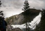 White Cascade near Glen Aulin High Sierra Camp, Yosemite National Park (37°54'22.1'' N, 119°25'6.0'' W, 2481 m) |
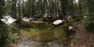 Small pond near Polly Dome Lakes, Yosemite National Park (37°52'18.6'' N, 119°27'41.9'' W, 2625 m) |
 Small pond near Polly Dome Lakes, Yosemite National Park (37°52'18.7'' N, 119°27'42.1'' W, 2626 m) |
 Climbing up towards May Lake, Yosemite National Park (37°51'19.7'' N, 119°28'21.3'' W, 2704 m) |
|
 Climbing up towards May Lake, Yosemite National Park (37°51'13.8'' N, 119°28'23.9'' W, 2754 m) |
|
 May Lake near sunset, Yosemite National Park (37°50'50.2'' N, 119°29'23.1'' W, 2874 m) |
|
 360° panoramic view at May Lake Campground, Yosemite National Park (37°50'40.1'' N, 119°29'30.1'' W, 2827 m) |
|
 Parking lot about 1.2 miles from May Lake, Yosemite National Park (37°49'58.2'' N, 119°29'27.0'' W, 2693 m) |
|
 West of Sunrise Lakes, Yosemite National Park (37°48'20.8'' N, 119°27'37.2'' W, 2633 m) |
 Tree at trail fork near Sunrise Lakes, Yosemite National Park (37°48'2.6'' N, 119°27'30.5'' W, 2825 m) |
 The southwest lake of the Sunrise Lakes, Yosemite National Park (37°48'18.1'' N, 119°27'10.2'' W, 2769 m) |
|
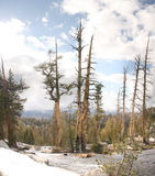 Trees between the Sunrise Lakes, Yosemite National Park (37°48'24.6'' N, 119°26'46.6'' W, 2880 m) |
|
 Between the Sunrise Lakes, Yosemite National Park (37°48'24.7'' N, 119°26'46.6'' W, 2884 m) |
|
 Our campsite south of Sunrise Lakes, Yosemite National Park (37°48'12.5'' N, 119°26'33.8'' W, 2913 m) |
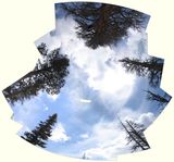 Looking at the sky near Sunrise High Sierra Camp, Yosemite National Park (37°47'41.0'' N, 119°26'2.6'' W, 2881 m) |
 Near Sunrise High Sierra Camp, Yosemite National Park (37°47'41.0'' N, 119°26'3.3'' W, 2900 m) |
 View near Columbia Finger, Yosemite National Park (37°49'0.2'' N, 119°25'19.3'' W, 3003 m) |
 Southern Cathedral Lake and Cathedral Peak, Yosemite National Park (37°50'12.7'' N, 119°24'55.2'' W, 2952 m) |
 360° panoramic view at our campsite at Cathedral Lakes, Yosemite National Park (37°50'46.7'' N, 119°25'11.2'' W, 2850 m) |
|||
 Northern Cathedral Lake, Yosemite National Park (37°50'44.6'' N, 119°25'20.5'' W, 2833 m) |
|||
 Ben at Northern Cathedral Lake, Yosemite National Park (37°50'44.6'' N, 119°25'20.6'' W, 2842 m) |
|||
 Tree near Cathedral Peak, Yosemite National Park (37°51'15.9'' N, 119°24'46.3'' W, 2909 m) |
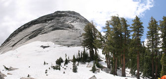 The northern tip of Cathedral Peak, Yosemite National Park (37°51'46.3'' N, 119°24'1.1'' W, 2754 m) |
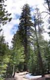 A huge tree east of Fairview Dome that needs to be hugged, Yosemite National Park (37°52'2.9'' N, 119°23'35.9'' W, 2781 m) |
 Tree hugging east of Fairview Dome, Yosemite National Park (37°52'2.9'' N, 119°23'34.2'' W, 2786 m) |
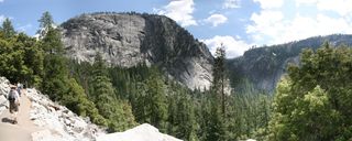 Panoramic view from Sierra Point on Panorama Cliff, Illilouette Gorge, and Happy Isles, Yosemite National Park (37°43'33.1'' N, 119°33'15.1'' W, 1444 m) |
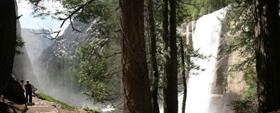 The Mist Trail at Vernal Fall, Yosemite National Park (37°43'35.9'' N, 119°32'38.9'' W, 1464 m) |
|||
 Looking down on the Mist Trail, Yosemite National Park (37°43'37.9'' N, 119°32'35.8'' W, 1464 m) |
 Looking down Vernal Fall, Yosemite National Park (37°43'37.9'' N, 119°32'35.8'' W, 1464 m) |
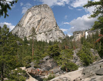 Looking at Liberty Cap and Nevada Fall from Merced River, Yosemite National Park (37°43'34.7'' N, 119°32'26.5'' W, 1556 m) |
 Tree near Liberty Cap, Yosemite National Park (37°43'33.8'' N, 119°31'54.1'' W, 1806 m) |
 Huge pine cones in Yosemite National Park (37°44'2.6'' N, 119°30'24.1'' W, 1933 m) |
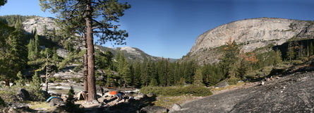 Our campsite next to the Merced River, between Moraine Dome and Bunnell Point, Yosemite National Park (37°44'11.8'' N, 119°28'49.5'' W, 1944 m) |
|
 Our campsite next to the Merced River, between Moraine Dome and Bunnell Point, Yosemite National Park (37°44'11.8'' N, 119°28'49.5'' W, 1944 m) |
 John Muir's book ``Yosemite'' and Moraine Dome, Yosemite National Park (37°44'11.8'' N, 119°28'49.5'' W, 1944 m) |
 Our camp site at Merced Lake High Sierra Camp, Yosemite National Park (37°44'27.2'' N, 119°24'25.4'' W, 2185 m) |
 View from a plateau northwest of Echo Valley, Yosemite National Park (37°45'4.3'' N, 119°26'40.6'' W, 2346 m) |
 Panoramic view from a plateau northwest of Echo Valley, Yosemite National Park (37°44'57.8'' N, 119°27'10.6'' W, 2309 m) |
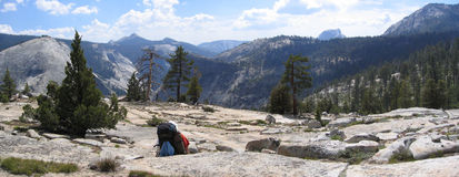 Mount Starr King and Half Dome in the background, Yosemite National Park (37°45'10.7'' N, 119°27'33.2'' W, 2405 m) |
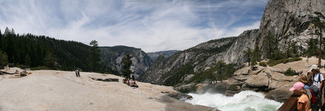 Panoramic view from the top of Nevada Fall, Yosemite National Park (37°43'29.2'' N, 119°31'59.3'' W, 1813 m) |
 Panoramic View on Half Dome, Mount Broderick, Liberty Cap, and Nevada Fall, Yosemite National Park (37°43'21.0'' N, 119°32'13.6'' W, 1827 m) |
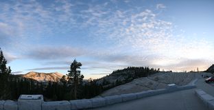 Olmsted Point, Yosemite National Park (37°51'49.4'' N, 119°21'59.5'' W, 2503 m) |
 Tufa at the south shore of Mono Lake (South Tufa Area) (37°56'35.6'' N, 119°1'38.3'' W, 1944 m) |
 Looking south at Zabriskie Point, Death Valley National Park (36°25'14.0'' N, 116°48'41.2'' W, 207 m |
 Looking north at Zabriskie Point, Death Valley National Park (36°25'12.4'' N, 116°48'44.5'' W, 218 m) |
 Looking west at Zabriskie Point, Death Valley National Park (36°25'11.9'' N, 116°48'44.4'' W, 216 m) |
|
 Ben's 360° panoramic view at Zabriskie Point, Death Valley National Park (36°25'11.9'' N, 116°48'44.4'' W, 215 m) |
|
|
Friederike's 360° panoramic view at Zabriskie Point, Death Valley National Park (36°25'12.2'' N, 116°48'44.0'' W, 217 m) |
|
 360° panoramic view at Dante's View, Death Valley National Park (36°13'4.1'' N, 116°43'45.2'' W, 1653 m) |
|
 Looking down into Death Valley from Dante's View (36°13'4.1'' N, 116°43'45.2'' W, 1651 m) |
|
 360° panoramic view a bit south of Dante's View, Death Valley National Park (36°13'35.2'' N, 116°43'31.2'' W, 1738 m) |
|
 Sunset at Francis Beach, Half Moon Bay (37°28'0.1'' N, 122°26'46.4'' W, 12 m) |
| [<- Overview] |